


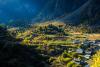
Lying between the forests and the Snow Mountains on the border of Tibet (Xizang Autonomous Region) and Yunnan Province, the secluded Tibetan village of Yubeng is praised as a unique place to escape.
Back in the days, the village was a sparsely populated area with only one horse trail connecting it with the outside world. These days, Yubeng is a trekking paradise, receiving hordes of people and an increasing number of global hikers coming to try discover this area for themselves.
Yubeng’s trekking route is praised as One of China's Top 10 Hiking Routes. Its pure landscapes, sprinkled with jaw-dropping snow mountains, with an alpine lake, a waterfall forest and glaciers have led to Yubeng becoming regarded as "The Epitome of Shangri-La."
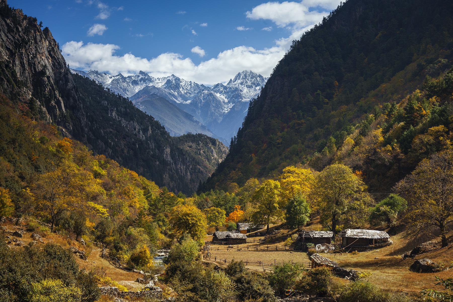
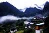
Whilst trekking in Yubeng, hikers can discover Tibetan villages festooned with prayer flags between glacial lakes and the mountains covered in snow.
You can experience four days of uncovering snow-capped peaks, deep valleys, alpine forests, secluded lakes and waterfalls. You just need to make sure you have enough energy to enjoy it all!
April to July is the most beautiful season of rainfall. Snow and ice are gradually melting and azaleas are everywhere, releasing a unique aroma amongst the vegetation.
Day 1: Feilaisi -- Upper Yubeng Village
Total Km: 18 kilometres
Total time: Four hours
Elevation Gain (Total): 1,100 metres (3,600 feet)
Start Elevation: 2635 metres (8,645 feet)
Highest Elevation: 3,729 metres (12,234 feet)
Transport to Xidang—the starting point of the trail by vehicle. It is a fairly steep hike with an almost 1000-metre altitude gain, from Xidang (2645 metres) to the highest point at Nanzheng Col (3729 metres).
After four hours of ascending, the amazing view starts to peek through when you descend into the village. The first glimpse of the snowy peaks will immediately make your fatigue fade.
You can also take a car instead, which is officially provided by the scenic area.
Day 2: Upper Yubeng Village -- Glacier Lake
Total Km: 12 kilometres
Total time: 10 hours
Elevation Gain: 793 metres (2,600 feet)
Start Elevation: 3,228 metres (10,590 feet)
Highest Elevation: 3,900 metres (12,800 feet)
On this day, you will uphill in the forest for two hours, before following a flat trail for one hour to Xiaonong Pasture (3608 metres). This is one of the very few places where you can buy food.
You can also have lunch at Xiaonong Farm/Kawagarbo (Kawagebo) Base Camp (3,608 metres).
Then, there’s time to keep walking through this meadowy pasture.
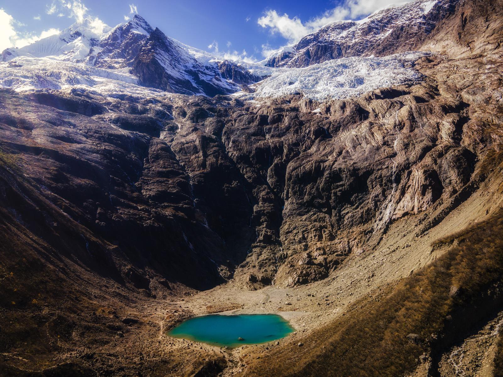
Because of the high altitude and difficulty, visitors seldom choose the tough route to the Sacred Lake, except for the adventurous extreme hikers.
Different from the other two routes, the way to get close to the Sacred Lake is all uphill. It is quite a challenge, requiring you to cover 1500 metres, which can take five to six hours.
The Glacier Lake (3900 metres) is uniquely beautiful and you can see the huge glaciers where the lake water comes from.
Day 3: Upper Yubeng Village -- Sacred Waterfall
Total Km: 12.8 kilometres
Total time: Eight hours
Elevation Gain: 775 metres (2,540 feet)
Start Elevation: 3,228 feet
Highest Elevation: 3,657 metres (12,000 feet)
Hiking through a beautiful forest lined with prayer flags, surrounded by glaciated peaks and with a mist of a waterfall, will be a dream come true for many visitors.
If you want to, you can join the locals in circling around the waterfall.
Day 4: Hiking out via Ninong
(4-6 hours, mostly all downhill.)
For some, the scenery between Yubeng and Ninong isn’t as spectacular as the scenery between Xidang and Yubeng, but it is, nonetheless, interesting.
Narrow paths are flanked by steep mountain slopes on one side and the plunging ravine on the other.
You can choose to hike out to Ninong Village as early as possible. You will need to go to Deqin bus station and catch the last bus to Shangri-La at 2:40pm.
Take car to Feilaishi, stay one night and then transport to Xidang and then start the journey.
Though the trail is well-used, it is safer not to hike alone. It might be best to travel with a partner, in a group or take a hiking trip organized by tour operator.
Upon arrival, take into account most people in the area can’t speak English.
There are no signs on the way and the trail is hidden. Therefore, it is very easy to get lost here.
Beware of occasional falling rocks after raining.


